 Skip to content


Qammouaa Plain Hiking Guide: Explore Akkar’s High Plateau and Ancient Forests
High in the mountains of northern Lebanon, the Qammouaa Plain (also spelled Qammoua, Qammouaa or Sahlet el Qammoua) offers one of the country’s most spectacular and least crowded natural landscapes. Located in the Akkar region near Fnaidek and Qobayat, this elevated plateau and surrounding forest complex sit at around 1,400–1,600 meters and form a vital water catchment area often called the “water tower” of northern Lebanon.
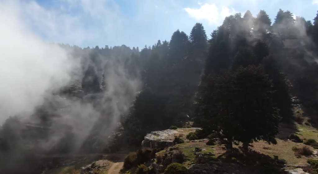
What makes Qammouaa special is the striking contrast between open high-altitude grasslands and dense forests of juniper (lezzeb), cedar, Cilician fir, iron oak (especially in the renowned Ezer Forest), and other species. Some trees are centuries old, creating a sense of wilderness rarely found so close to the coast. For hikers seeking pure nature, wide views, autumn colors, and solitude, Qammouaa ranks among Lebanon’s finest destinations.
Quick Overview
- Location: Akkar Governorate, northern Lebanon (near Fnaidek / Fneidek and Qobayat)
- Elevation: Approximately 1,400–1,600 m on the main plateau
- Highlights: Open plain, ancient forests, biodiversity, panoramic mountain views
- Best for: Nature lovers, hikers of various levels, photography, autumn foliage
- Character: Remote, peaceful, low light pollution
What Makes the Qammouaa Plain Unique
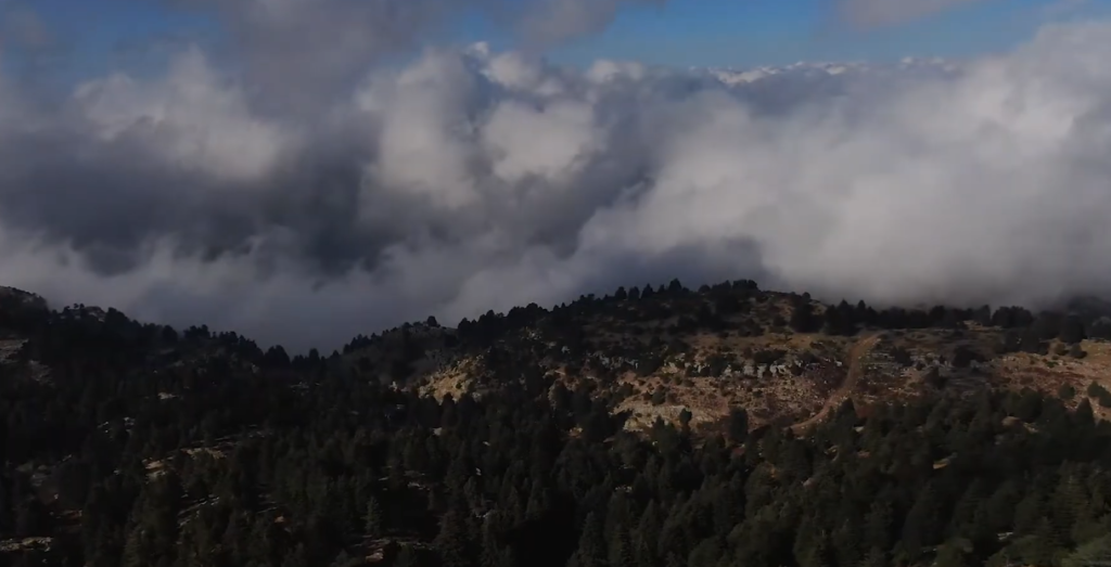
The Qammouaa area is one of Lebanon’s most important forest regions, covering a large stretch of the northern Mount Lebanon range. It features a rich mosaic of ecosystems: windswept grasslands on the plateau, deep valleys, springs, rocky formations, and extensive woodlands containing millions of trees across dozens of species.
The Ezer (or Azer) Forest, famous for its tall iron oaks, stands out as particularly beautiful, especially in autumn when the foliage turns rich shades of gold and red. The open plain itself provides expansive skies and a feeling of space that contrasts sharply with the denser forests lower down. Wildlife, wildflowers in spring, and excellent stargazing complete the experience.
Hiking Possibilities at Qammouaa Plain
Hiking is the main reason to visit, and options range from short easy walks to longer moderate trails.
Popular routes include:
- Short loops and forest walks on the plateau itself (around 3–8 km). These offer gentle terrain ideal for families or a relaxed half-day outing with views across the grasslands and into the surrounding mountains.
- Trails linking the Qammouaa plateau with the Ezer Forest and nearby valleys (typically 8–12 km). These are of moderate difficulty with a mix of open ground, forest paths, and mild elevation changes. They showcase the area’s biodiversity and famous old trees.
- Longer routes such as the climb from Qobayat (Mar Challita area) up to the plain (14–16 km with significant elevation gain). This is a rewarding full-day hike that transitions through different forest zones before opening onto the high plateau.
- Combinations with parts of the Lebanon Mountain Trail (LMT) or descents toward villages like Tachaa or other Akkar settlements.
Most trails are unmarked or only lightly marked, so a local guide or reliable GPS track is strongly recommended. Terrain is generally straightforward but can include uneven ground, rocky sections, and exposure on the open plain. Sturdy hiking shoes, sufficient water, and sun protection are essential.

Practical Information
There are no formal visitor centers or ticket offices. Access is free, though some organized group hikes charge for transport and guiding. Facilities are minimal. Expect no reliable water sources, toilets, or services on the trails. Carry everything you need and pack out all waste.
Allow half a day for shorter loops or a full day for longer routes. Camping is possible in primitive conditions on the plateau, but leave no trace.
Best Time to Visit and Tips
Spring (April–June) brings green landscapes and wildflowers. Autumn (September–November) is outstanding for foliage colors, especially in the oak forests. Summer can be hot and exposed on the open plain. Winters may bring snow and colder conditions.
Tips for a great visit:
- Start early to enjoy cooler temperatures and softer light.
- Hire a local guide if you are unfamiliar with the area. Trails can be confusing and mobile signal is limited.
- Respect the fragile environment. Stay on paths where possible and avoid damaging vegetation.
- Bring layers. Temperatures drop quickly at altitude, especially in the evening.
- Combine with nearby villages for traditional meals after your hike.
How to Get to Qammouaa Plain
The area is roughly 2.5–3.5 hours by car from Beirut, depending on traffic and exact starting point. Drive north toward Tripoli, then continue into Akkar via Qobayat or Fnaidek. From these villages, rough or secondary roads lead up to the plateau access points.
Public transport is limited. Most visitors come by private car or with organized hiking groups that provide bus transport from Beirut or other cities. Navigation apps help, but local knowledge is valuable for the final approach.
Nearby Attractions
The wider Akkar region offers additional nature and cultural sites, including other forest areas, traditional villages, and viewpoints. Many hikers pair a Qammouaa day with visits to nearby towns for local food or overnight stays in simple guesthouses.
Frequently Asked Questions
Is Qammouaa suitable for beginners?
Yes. Shorter plateau and forest loops are accessible. Longer climbs require moderate fitness.
Do I need a guide?
Highly recommended for safety and navigation, especially on longer or less-marked routes.
What is the best season for colors?
Autumn for the iron oak and mixed forest foliage.
Are there facilities on the trails?
Very few. Come fully prepared with water, food, and navigation tools.
Plan Your Qammouaa Hiking Adventure
The Qammouaa Plain rewards those who venture into Lebanon’s wild north with open skies, ancient trees, and a profound sense of space. Whether you choose a gentle walk across the grasslands or a longer forest-to-plateau trek, this high-altitude landscape delivers one of the purest nature experiences in the country.
Prepare well, travel respectfully, and you will leave with lasting memories of Akkar’s hidden highland beauty. For current trail conditions or guided options, check with local hiking groups or Akkar tourism contacts before setting out.

