Skip to content


Lebanon’s Natural Wonders in 360° Street View
A Detailed Virtual Guide to Nature Sites from Qlayaat Airport
Lebanon may be a small country, but it is extraordinarily rich in natural beauty. From ancient cedar forests and dramatic waterfalls to deep valleys and Mediterranean rock formations, the landscape offers some of the most memorable outdoor experiences in the Middle East.
Google’s official Street View Special Collection includes many of these outstanding natural sites. Below you will find detailed descriptions of the most important nature destinations captured in high-quality 360° imagery. Each entry includes background information, what makes the place special, and approximate travel time from Qlayaat Airport (René Mouawad International Airport – IATA: KYE).
These virtual tours are ideal for planning day trips or multi-day nature itineraries after you land in northern Lebanon.
1. Rock of Raouché (Pigeons’ Rock)
Rock of Raouché, also known as Pigeons’ Rock, is one of Beirut’s most iconic natural landmarks. These two enormous limestone rocks rise dramatically from the Mediterranean Sea just off the Corniche. Over thousands of years, wind and waves have sculpted the formations into their distinctive shapes, creating arches and caves that are especially striking at sunset.
The site is a popular gathering place for both locals and visitors. People come to walk along the waterfront, watch the waves crash against the rocks, enjoy fresh fish restaurants nearby, or simply take photographs. The area is particularly beautiful in the late afternoon when the soft light turns the stone golden and pink.
View in 360° Street View:
Distance from Qlayaat Airport: Approximately 2 hours to Beirut’s western coastline.
2. Al Shouf Cedar Nature Reserve
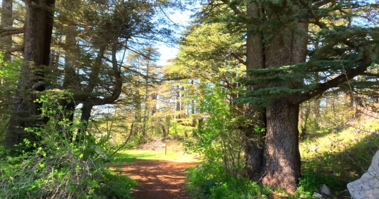
Al Shouf Cedar Nature Reserve is the largest nature reserve in Lebanon and one of the most important protected areas in the Middle East. Covering more than 500 square kilometres in the Chouf Mountains, it contains three major cedar forests and a remarkable diversity of flora and fauna.
The reserve is home to the famous Lebanese cedar (Cedrus libani), the national emblem of the country. Visitors can walk along well-marked hiking trails that wind through ancient trees, some of which are hundreds or even thousands of years old. In addition to the cedars, the reserve protects a wide range of wildflowers, birds (including rare migratory species), and mammals. It is also recognised as a UNESCO Biosphere Reserve.
View in 360° Street View:
Distance from Qlayaat Airport: Approximately 2 hours 45 minutes to 3 hours.
3. Chekka
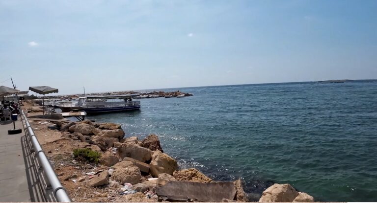
Chekka is a coastal area in northern Lebanon known for its scenic Mediterranean shoreline, rocky coves and relatively unspoiled natural setting. Located between Tripoli and Batroun, it offers a quieter alternative to the more developed beach resorts further south.
The coastline features clear waters, interesting rock formations and pleasant walking paths along the sea. Chekka is also close to several small beaches and viewpoints that provide excellent opportunities for photography and relaxation. Its position makes it a convenient stop for travellers driving south from Qlayaat Airport along the coastal road.
View in 360° Street View:
Distance from Qlayaat Airport: Approximately 1 hour 15–30 minutes.
4. Bsharri
Bsharri is a historic mountain town in northern Lebanon and the gateway to some of the country’s most spectacular natural landscapes. Situated at a high elevation in the Qadisha region, the town is surrounded by rugged mountains, deep valleys and cedar forests.
Bsharri is closely associated with the famous Lebanese writer and artist Khalil Gibran, whose museum is located here. Beyond its cultural importance, the town serves as an excellent base for exploring the surrounding nature, including the Cedars of God and the Qadisha Valley. The clean mountain air, traditional stone architecture and dramatic scenery make Bsharri one of the most atmospheric destinations in the north.
View in 360° Street View:
Distance from Qlayaat Airport: Approximately 1 hour 45 minutes to 2 hours.
5. Shouf Biosphere Reserve (Maasser Cedar Forest)
The Maasser Cedar Forest is one of the key cedar stands within the larger Shouf Biosphere Reserve. This protected area forms part of the most extensive cedar forest system remaining in Lebanon and plays a vital role in conserving the country’s national tree.
The forest offers beautiful walking trails among mature cedar trees, with opportunities to observe wildlife and enjoy the mountain environment. As part of the UNESCO-recognised Shouf Biosphere Reserve, the site is managed with a focus on both conservation and sustainable tourism. It is an excellent destination for travellers who want to experience Lebanon’s highland nature at its best.
View in 360° Street View:
Distance from Qlayaat Airport: Approximately 2 hours 45 minutes to 3 hours.
6. Mzaar / Mount Sannine
Mount Sannine is one of the most prominent peaks in the Mount Lebanon range and a major destination for outdoor enthusiasts. The Mzaar area on its slopes is best known as Lebanon’s largest ski resort in winter, but the mountain is equally attractive in other seasons for hiking, paragliding and enjoying panoramic views.
From the higher elevations, visitors can see both the Mediterranean Sea to the west and the Bekaa Valley to the east on clear days. The combination of alpine scenery, fresh mountain air and accessibility makes Mzaar / Mount Sannine a favourite escape from the heat of the coast and cities.
View in 360° Street View:
Distance from Qlayaat Airport: Approximately 2 hours 15–30 minutes.
7. Lake Bnachei
Lake Bnachei is a serene mountain lake located in a quiet, elevated area of Lebanon. Surrounded by hills and vegetation, it offers a peaceful atmosphere that contrasts with the more dramatic landscapes of the high mountains and deep valleys.
The lake is popular for short walks, birdwatching and relaxing in nature. Its calm waters and scenic setting make it a pleasant destination for travellers seeking tranquillity. The surrounding countryside is characterised by traditional villages and agricultural terraces that add to the rural charm of the region.
View in 360° Street View:
Distance from Qlayaat Airport: Approximately 2–2.5 hours.
8. Ibrahim River
The Ibrahim River (also known as Nahr Ibrahim or Adonis River) is one of Lebanon’s most beautiful and historically significant rivers. Flowing from the mountains down to the Mediterranean, it has carved a scenic valley known for its lush greenery, waterfalls and mythological associations.
In ancient times the river was linked to the legend of Adonis and Aphrodite. Today it is appreciated for its natural beauty, clear water and the opportunity for riverside walks and swimming in certain spots during summer. The valley is particularly attractive in spring when the vegetation is at its greenest.
View in 360° Street View:
Distance from Qlayaat Airport: Approximately 1 hour 45 minutes to 2 hours.
9. Ouadi Qadisha (Holy Valley)
Ouadi Qadisha, or the Holy Valley, is a dramatic gorge in northern Lebanon and a UNESCO World Heritage Site. The deep valley is lined with ancient monasteries, hermitages and caves that have been used by Christian communities for more than 1,500 years.
The combination of spectacular natural scenery and spiritual heritage makes Qadisha unique. Visitors can hike along trails that offer views of the steep cliffs, terraced cultivation and historic religious sites clinging to the rock faces. The valley is especially beautiful in autumn when the foliage changes colour and in spring when wildflowers bloom.
View in 360° Street View:
Distance from Qlayaat Airport: Approximately 1 hour 45 minutes to 2 hours (very convenient from the north).
10. Cedars Forest (Cedars of God)
The Cedars of God (Horsh Arz el-Rab) is the most famous cedar forest in Lebanon and part of the UNESCO World Heritage listing together with the Qadisha Valley. Located near Bsharri at an elevation of around 2,000 metres, this small but ancient grove contains some of the oldest and most majestic cedar trees in the country.
Some of the trees are estimated to be over 1,000 years old, with massive trunks and wide-spreading branches. The site has deep cultural and historical significance — cedar wood from Lebanon was prized in antiquity and mentioned in many ancient texts. Today the forest is carefully protected and offers a profound sense of connection to Lebanon’s natural and national identity.
View in 360° Street View:
Distance from Qlayaat Airport: Approximately 2 hours.
11. Baatara Waterfall
Baatara Waterfall (also known as the Three Bridges Waterfall or Baatara Gorge Waterfall) is one of Lebanon’s most spectacular natural attractions. Located near Tannourine, the waterfall plunges approximately 255 metres into a cave through three natural stone bridges.
The sight of the water disappearing into the deep chasm is unforgettable, especially in spring when snowmelt increases the flow. Visitors can walk around the rim of the gorge and look down through the successive rock arches. The surrounding landscape of cliffs and Mediterranean vegetation adds to the dramatic effect.
View in 360° Street View:
Distance from Qlayaat Airport: Approximately 2 hours 15–30 minutes.
Planning Nature Trips from Qlayaat Airport
Qlayaat Airport’s location in northern Lebanon makes it an ideal starting point for many of these natural sites. The Qadisha Valley, Cedars of God, Bsharri and Chekka are all relatively close and can be visited as day trips. Sites further south, such as the Shouf Cedar Reserve and Baakline Waterfalls, require more travel time but reward visitors with outstanding landscapes.
Use the 360° Street View links above to explore each destination virtually, then plan your real itinerary once you arrive. Lebanon’s combination of mountains, forests, rivers and coastline offers outdoor experiences that few countries of similar size can match.
Would you like me to create a combined “Heritage + Nature” page, add best visiting seasons, or prepare a shorter card-style version for the homepage?
Related Posts - Explore Lebanon